Vessel Traffic Analysis — Updated Every 30 Minutes
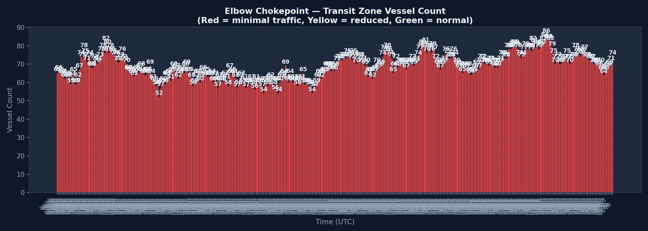
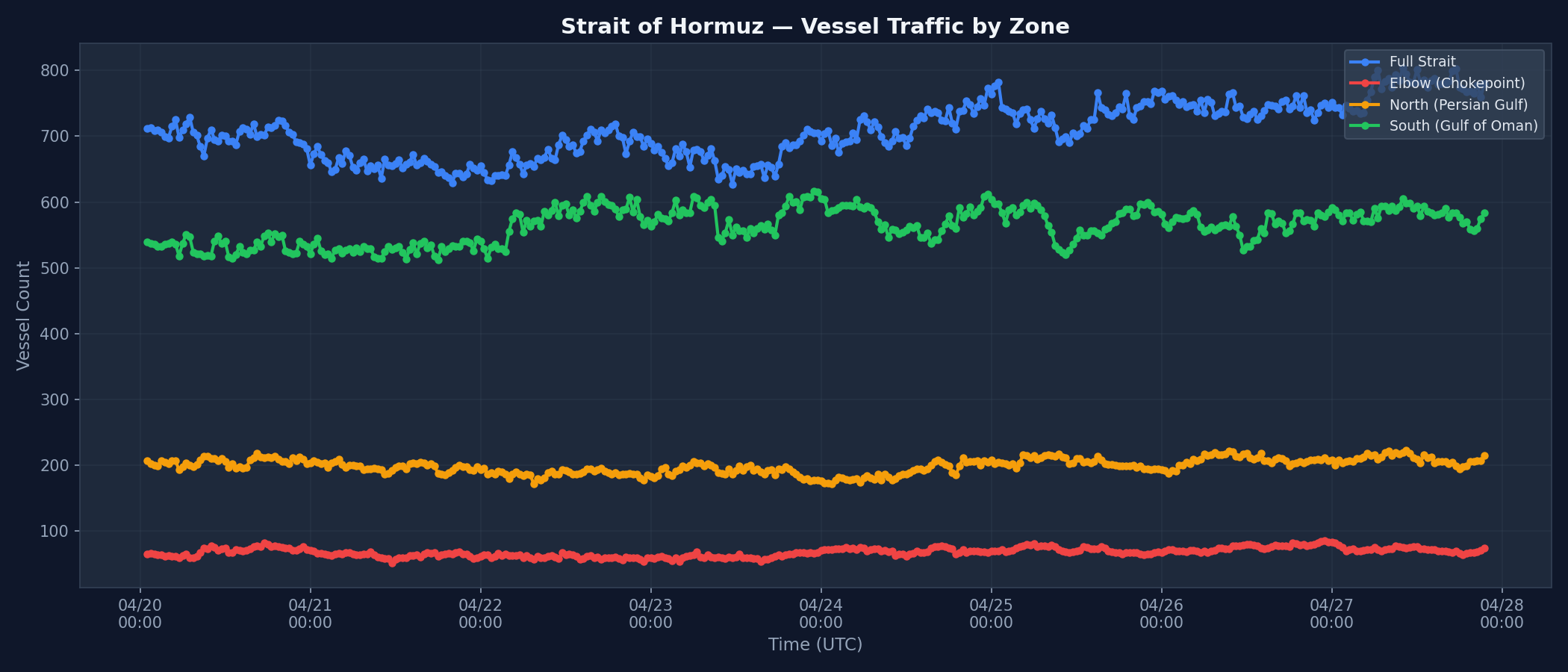
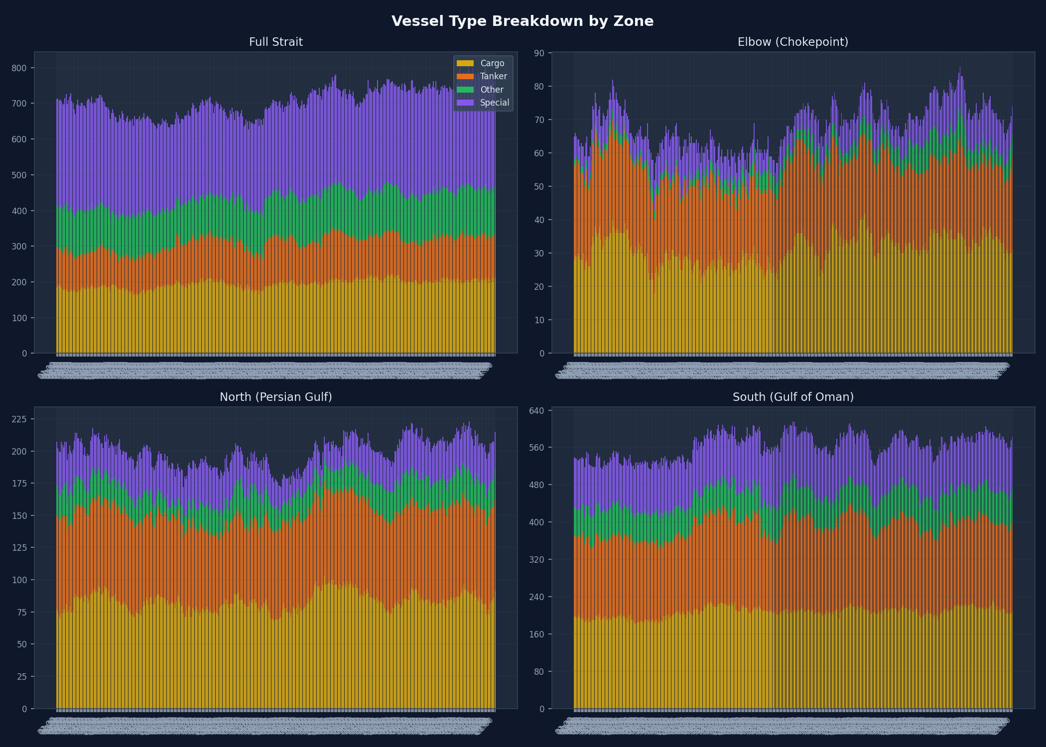
Analysis based on automated AIS vessel position captures. Vessel counts derived from satellite-fed map data via computer vision. Charts update every 30 minutes. Data collection began April 19, 2026.
Analysis based on automated AIS vessel position captures. Vessel counts derived from satellite-fed map data via computer vision. Charts update every 30 minutes. Data collection began April 19, 2026.